PointNeXt Adapter Model for Low Altitude Route Conflict Detection in UAV Trajectory Intent Streams
Authors
Srđana Milošević, Bogdana KostićFiles
Key Information
Journal
Published in Vol. 6 No. 3 (2026) of Journal of Smart Operations and Management Engineering.
Journal of Smart Operations and Management Engineering (JSOME) eISSN: 3136-7666 is an international, peer-reviewed forum dedicated to publishing cutting-edge research at the intersection of process systems engineering, advanced operations research, and intelligent management. The journal bridges the gap between technical system design and executive decision-making, focusing on how data-driven algorithms, automation frameworks, and intelligent computing transform modern industrial operations.
JSOME welcomes original research articles, rigorous reviews, and methodological contributions addressing complex industrial systems, supply chain networks, energy systems, and process industries.
About the JournalAbstract
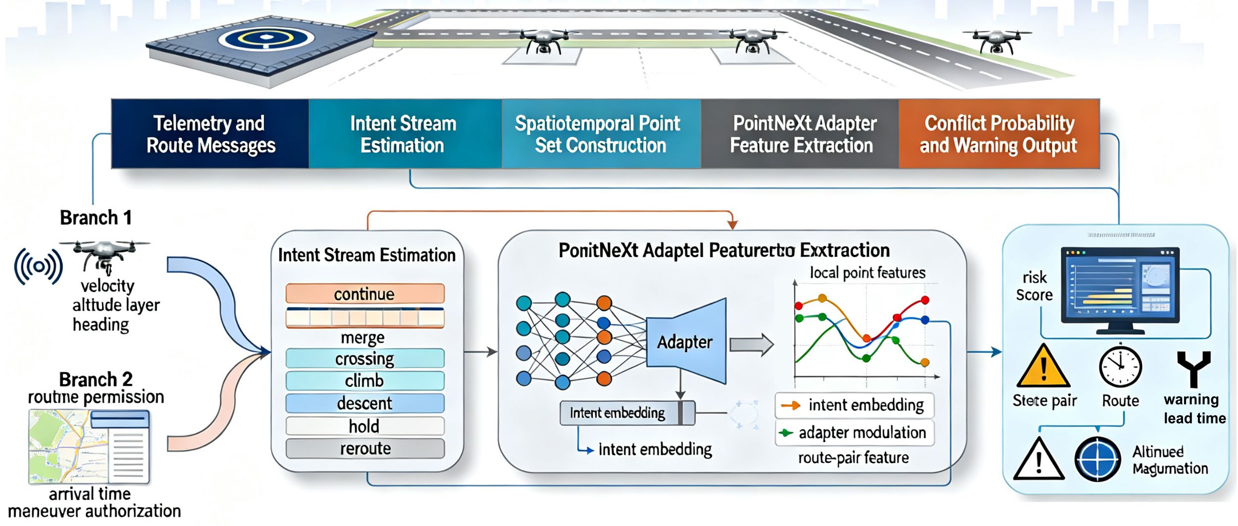
Low-altitude UAV routes are increasingly organized as time-dependent corridors, but conflict detection remains vulnerable when vehicles change speed, altitude, or maneuver intention before a formal route update is broadcast. This paper proposes a PointNeXt Adapter model for low-altitude route conflict detection in UAV trajectory intent streams. Each traffic scene is encoded as a spatiotemporal point set containing position, velocity, altitude layer, maneuver probability, and route- permission attributes. The proposed model couples a PointNeXt geometric backbone with lightweight adapter blocks that modulate intermediate point features by temporal intent embeddings, rather than simply appending intent variables at the final classifier. A mixed-source evaluation corpus containing 62,050 trajectories and 9,928 conflict windows was constructed from urban corridor replay, vertiport approach simulation, inspection logs, emergency rerouting scenarios, and weather-perturbed augmentation. Compared with PointNet++, DGCNN, Point Transformer, and recurrent or graph-based baselines, the proposed model achieved 95.8% accuracy, 94.6% F1 score, 0.963 AUROC, and 37 ms median inference latency per 128-trajectory scene. The results indicate that intent-conditioned point adaptation can improve early warning reliability under controlled mixed-source evaluation while preserving a computational profile suitable for engineering traffic-monitoring studies.
Details
License
Copyright (c) 2026 Srđana Milošević, Bogdana Kostić

This work is licensed under a Creative Commons Attribution-NonCommercial-ShareAlike 4.0 International License.