A Cross-Scale GraphGPS Model for Space Debris Track Association
Authors
Maja Ratajczak, Hanna Romanowska, Aleksander Maciej BorowiecFiles
Key Information
Journal
Published in Vol. 6 No. 2 (2026) of Journal of Smart Operations and Management Engineering.
Journal of Smart Operations and Management Engineering (JSOME) eISSN: 3136-7666 is an international, peer-reviewed forum dedicated to publishing cutting-edge research at the intersection of process systems engineering, advanced operations research, and intelligent management. The journal bridges the gap between technical system design and executive decision-making, focusing on how data-driven algorithms, automation frameworks, and intelligent computing transform modern industrial operations.
JSOME welcomes original research articles, rigorous reviews, and methodological contributions addressing complex industrial systems, supply chain networks, energy systems, and process industries.
About the JournalAbstract
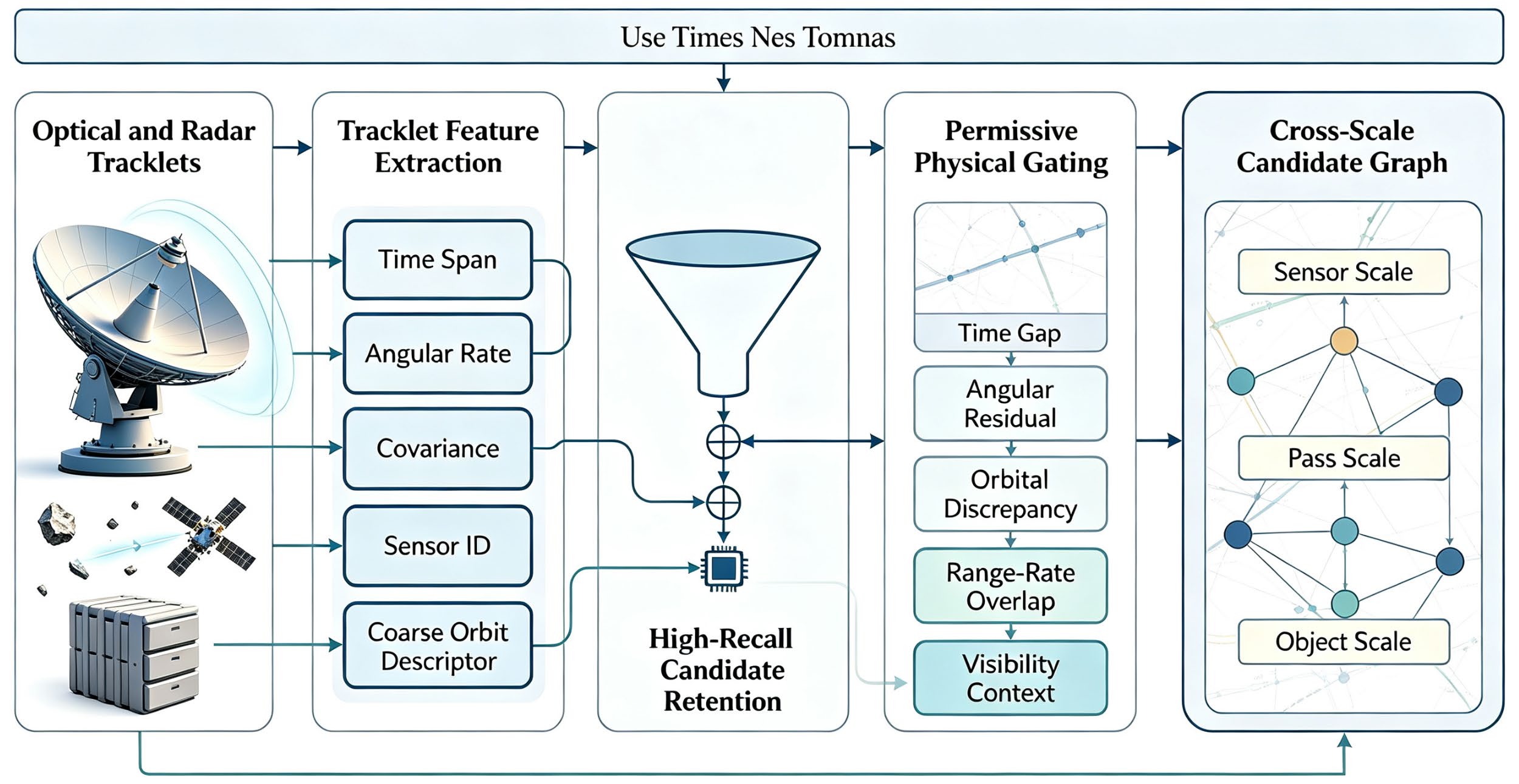
Space debris track association remains difficult when surveillance arcs are short, revisit intervals are irregular, and multiple fragments occupy nearby orbital corridors. This paper proposes a cross-scale GraphGPS model that represents candidate tracklets as graph nodes and combines local message passing, global attention, and physics-aware edge encoding for robust association. The method first builds a gated multi-scan graph from angular residuals, time gaps, admissible range-rate intervals, and coarse orbital-element consistency. A GraphGPS backbone then fuses local neighborhood evidence with global context, while a cross-scale pooling layer exchanges information between sensor-level, pass-level, and object-level representations. Experiments on a simulated low-Earth-orbit surveillance benchmark with 18,240 tracklets, 3,760 catalogued objects, and controlled sensor noise show that the proposed model reaches 94.8% association F1, reduces identity switches by 38.6% against a graph neural network baseline, and keeps median inference latency at 41.7 ms per association window. Under dense-fragment conditions, the model preserves 91.2% precision when the average candidate degree increases from 11.4 to 37.9. Ablation results indicate that cross-scale pooling contributes 2.9 percentage points of F1 and physics-aware edge encoding contributes 3.4 percentage points. The results suggest that cross-scale graph reasoning is a practical route for space situational awareness systems that require both accuracy and bounded computational cost.
Details
License
Copyright (c) 2026 Maja Ratajczak, Hanna Romanowska, Aleksander Maciej Borowiec

This work is licensed under a Creative Commons Attribution-NonCommercial-ShareAlike 4.0 International License.