Road Work-Zone Capacity Prediction Under UAV Traffic Video and Detector Data Using an Improved SAM2-TinyViT Model
Authors
Files
Key Information
Journal

Published in Vol. 4 No. 1 (2026) of Journal of Data‑Centric Engineering Science.
Journal of Data‑Centric Engineering Science eISSN 3136-814X is an international, peer‑reviewed open‑access journal. It publishes high‑quality original research, methodological advances, comprehensive reviews, dataset papers and short communications concerning fundamental theories, scientific methodologies and cross‑domain engineering applications under the data‑centric paradigm. This journal focuses on underlying scientific problems of data‑driven engineering, promotes the integration of data science and physical‑mechanism‑based engineering science, and builds an interdisciplinary platform for academic researchers and industrial scientists.
About the JournalAbstract
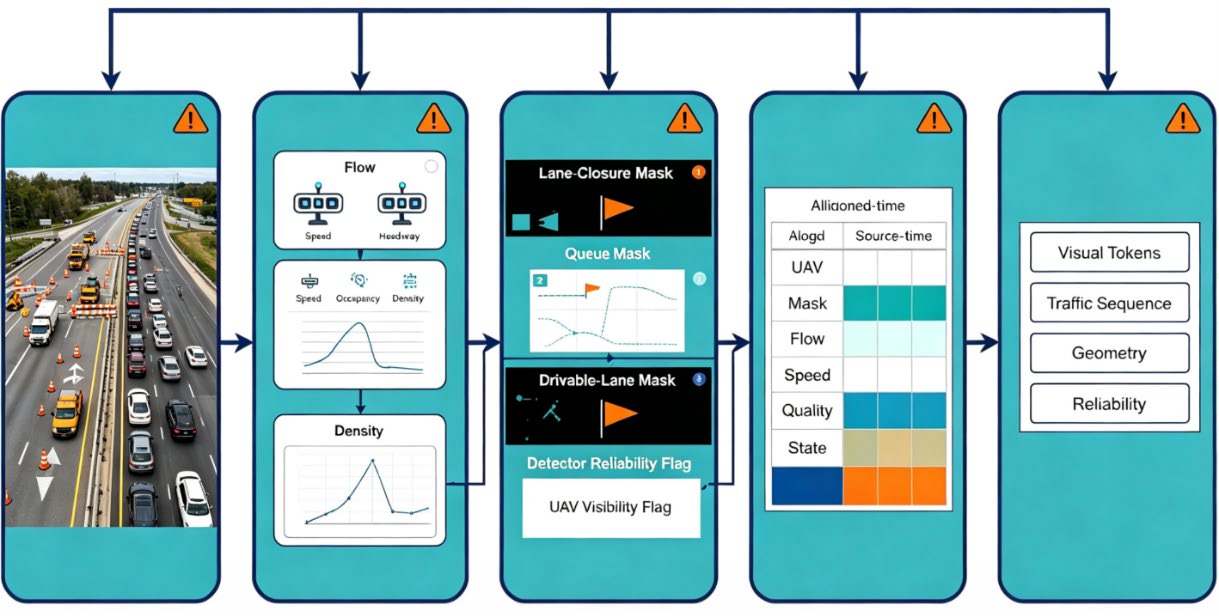
Road work-zone capacity prediction is required for lane-closure planning, queue warning, temporary speed-control review and construction-zone management, but the problem is difficult because capacity is jointly affected by work-zone geometry, lane occupation, heavy-vehicle ratio, merging behaviour, weather visibility, detector reliability and UAV viewing conditions. This paper proposes an improved SAM2-TinyViT model for road work-zone capacity prediction using UAV traffic video and detector data. UAV frames are segmented into open-lane masks, closed-lane masks, drivable regions, queue areas and construction-activity zones by a SAM2-based visual branch. Detector sequences provide flow, speed, occupancy, headway, density and discharge-response descriptors, while source reliability flags indicate viewpoint shift, occlusion, detector dropout and timestamp uncertainty. TinyViT converts mask-guided regions into lightweight visual tokens, and a fusion module integrates spatial bottleneck evidence with detector-based temporal response. The model outputs short-term work-zone capacity, congestion-state class, bottleneck evidence, confidence and recommended management review. Experiments use a simulated multi-work-zone dataset covering lane closure, shoulder occupation, moving maintenance, temporary speed control, heavy-vehicle mixing, queue spillback, detector dropout and unseen-site testing. The framework is designed as traffic-manager decision support for queue warning, speed-control review, lane-control review and manual inspection, rather than a direct automatic control command.
Details
License
Copyright (c) 2026 Damian Przybylski

This work is licensed under a Creative Commons Attribution-NonCommercial-ShareAlike 4.0 International License.