ConvNeXtV2 CBAM Framework for Urban Drone Noise Footprint Prediction from Flight Paths and Building Morphology
Authors
Files
Key Information
Journal

Published in Vol. 4 No. 2 (2026) of Journal of Data‑Centric Engineering Science.
Journal of Data‑Centric Engineering Science eISSN 3136-814X is an international, peer‑reviewed open‑access journal. It publishes high‑quality original research, methodological advances, comprehensive reviews, dataset papers and short communications concerning fundamental theories, scientific methodologies and cross‑domain engineering applications under the data‑centric paradigm. This journal focuses on underlying scientific problems of data‑driven engineering, promotes the integration of data science and physical‑mechanism‑based engineering science, and builds an interdisciplinary platform for academic researchers and industrial scientists.
About the JournalAbstract
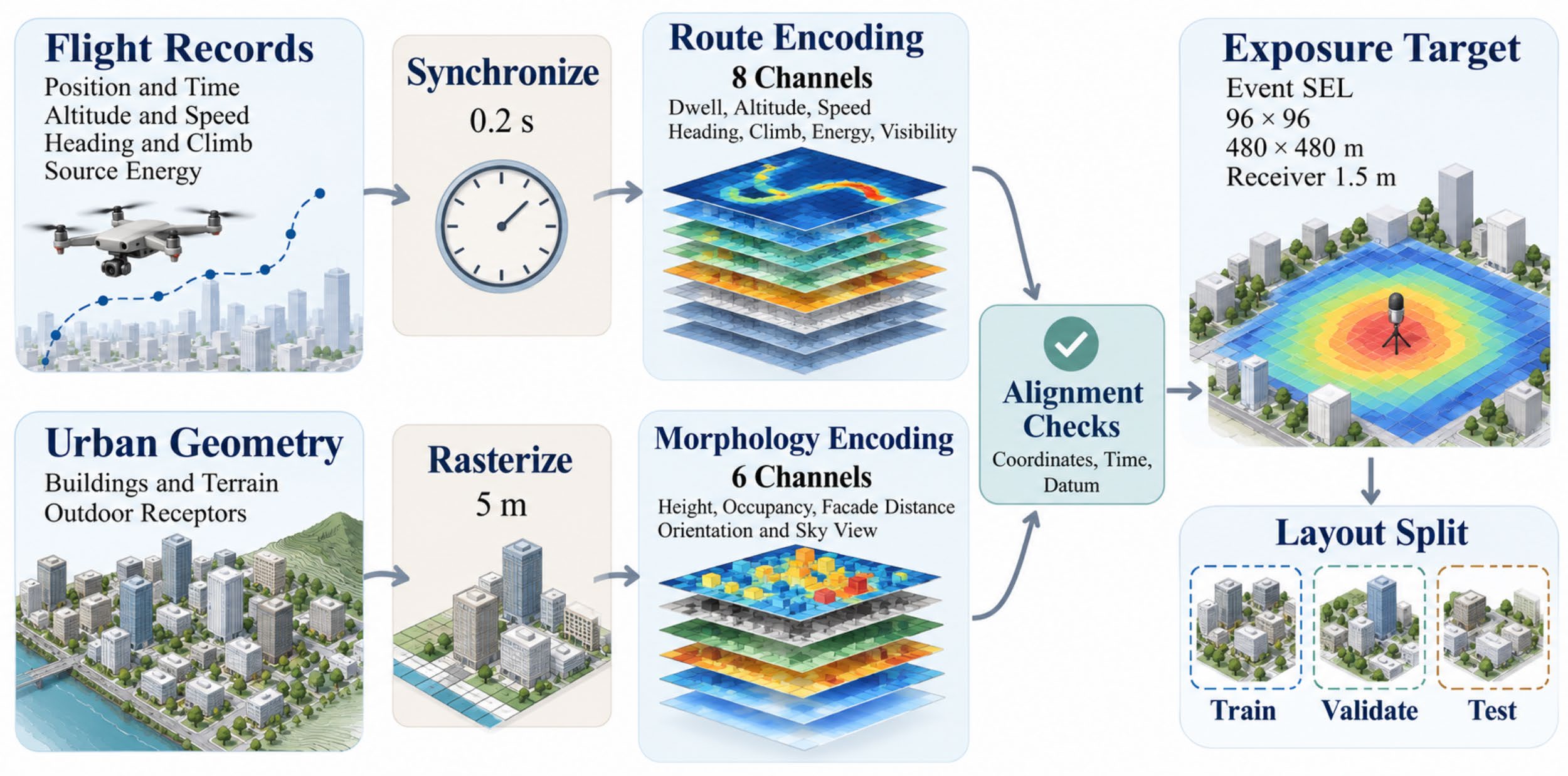
Urban drone route noise prediction requires spatial assessment of both flight geometry and the surrounding built environment. This paper specifies a ConvNeXtV2 network with convolutional block attention for predicting event sound exposure maps from synchronized flight paths and building morphology. Route information is encoded as dwell time, altitude, speed, heading, and source energy rasters, while a parallel morphology stream represents building height, occupancy, facade orientation, and visibility. Hierarchical fusion and a multiscale decoder support detailed footprint reconstruction. The numerical evaluation uses six comparison cases across 120 route events on 96 by 96 receptor grids, covering five urban forms and five operating heights. Within this comparison collection, the event-averaged root mean squared error (RMSE) is 2.40 dB for the complete attention case and 3.10 dB for the backbone case, giving a relative difference of 22.6%. Mean absolute error is approximately 1.91 dB, and the fraction of receptors within 3 dB is approximately 79.0%. Morphology stratification, altitude conditioning, footprint thresholds, and adverse input analyses examine the behavior of these comparison cases. The architecture specification links source timing and urban geometry to event exposure prediction, while the evaluation protocol combines receptor errors, spatial footprint metrics, and event- level statistics. The contribution is an encoding and assessment framework whose predictive accuracy requires subsequent network training and independent acoustic validation.
Details
License
Copyright (c) 2026 Valentin Aigner, Laura Wimmer

This work is licensed under a Creative Commons Attribution-NonCommercial-ShareAlike 4.0 International License.