UWB and Inertial-Measurement-Driven Res2Net-Triplet Model for Mine-Roadway Personnel Positioning Correction
Authors
Kovács István, Nagy Péter, Farkas TamásFiles
Key Information
Journal

Published in Vol. 4 No. 1 (2026) of Journal of Applied Computational Intelligence.
The Journal of Applied Computational Intelligence (JACI) eISSN:3136-6937 is a peer-reviewed, international, open-access journal dedicated to the advancement of computational intelligence methodologies and their real-world applications across diverse engineering and scientific domains. The journal aims to bridge the gap between theoretical development and practical deployment of intelligent systems by providing a scholarly platform for researchers, practitioners, and industry innovators.
JACI encourages high-quality original research, review articles, and technical reports that explore the design, implementation, and optimization of intelligent algorithms for solving complex problems in fields such as manufacturing, energy, healthcare, transportation, and information systems.
Abstract
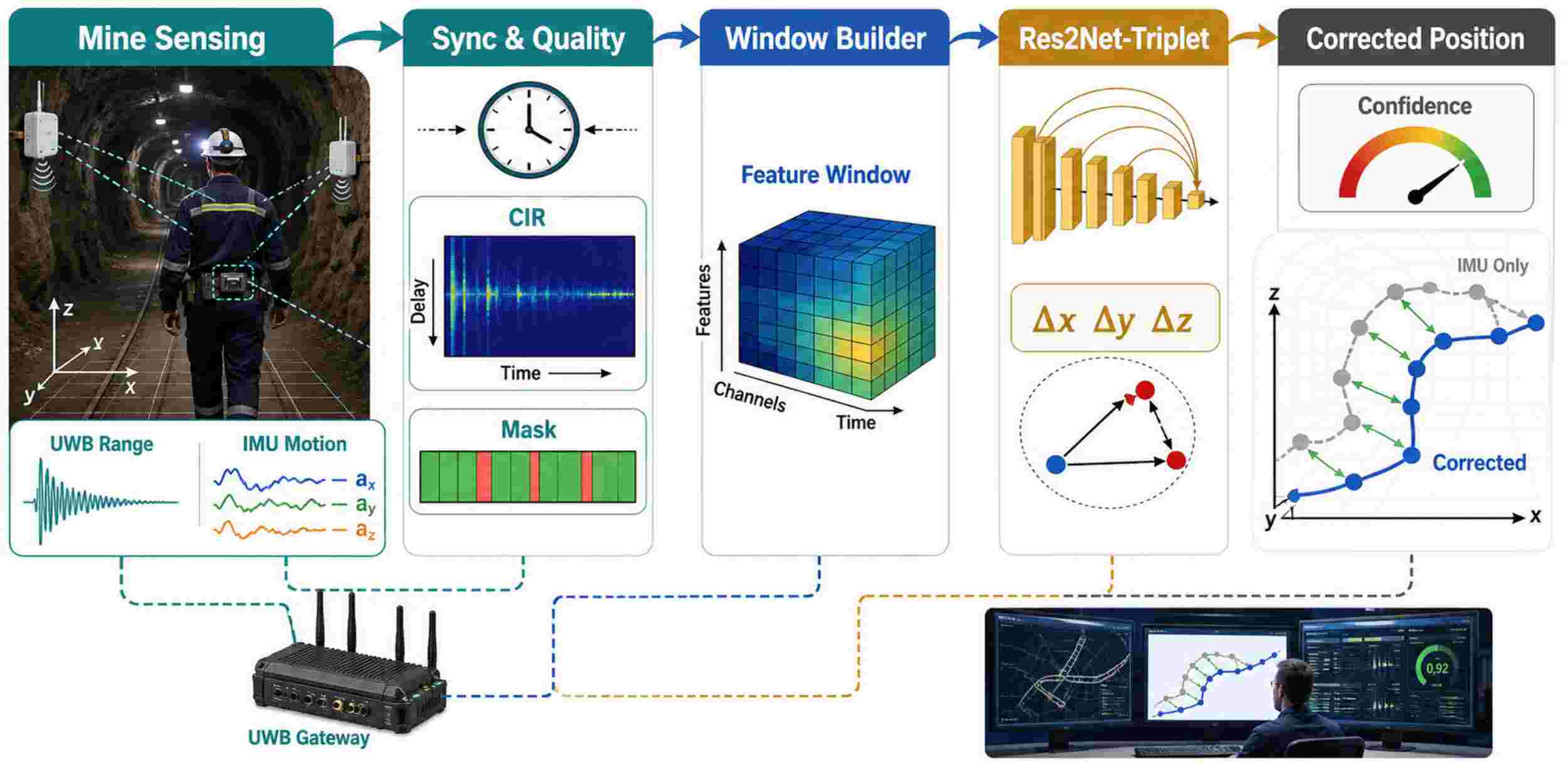
Accurate positioning of underground personnel is still challenging due to non-line-of-sight propagation of UWB ranging, metallic equipment, irregular tunnel structures, and inertial drift caused by walking. This paper proposes a UWB-and-inertial-measurement-driven Res2Net-Triplet model for mine-roadway positioning correction to improve the average accuracy and tail-error control without modifying the deployed ranging infrastructure. Convert synchronous UWB ranges, channel-quality descriptors, accelerometer windows, gyroscope windows, anchor-visibility masks and coarse coordinates into a multi-scale temporal representation. Res2Net blocks capture short disturbance spikes and wider motion context, and triplet metric learning separates correction patterns caused by open-view walking, partial shielding, turning, and severe NLOS disturbance. A lightweight regression head estimates coordinate offsets and does not replace the physical localisation solution. In a simulated roadway dataset with 18 routes, 42 anchor configurations and 12,600 labeled trajectory windows, the proposed model reduced the three-dimensional mean absolute positioning error from 0.94 m to 0.31 m and decreased the 95th-percentile error from 2.18 m to 0.76 m. Compared with EKF, LSTM and a plain residual CNN baseline, the method improves F1 detection of high-risk error windows to 0.91, reduces the mean error of turning-NLOS to 0.38 m, and keeps the median correction latency at 18.7 ms per window. The results show that multi-scale residual features and distance-constrained embeddings can address the problems of altered anchor geometry, body shielding and inertial drift along the route practically.